Norman tracks / map

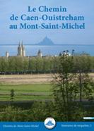
The CAEN ROUTE
The way of Cean on Google Map
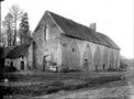
 - Caen, Vaucelles
The itinerary starts at the port of Ouistreham, where today the ferries arrive from Portsmouth and which in medieval times served the city of Caen which can be reached by following the path along the River Orne. Caen has been an important stop for travellers and pilgrims since the early middle ages. In 1083 Caponière Street leading out of the town was reffered to as "the street leading to Mont St Michel". The shortest way from Caen used to be through Villers-Bocage, but now it has become a motorway. Instead we can take another ancient way, along the Roman road connecting Vieux with Avranches. This route was used by travellers, and for the transport of goods and mail from antiquity until the end of the eighteenth century. From the plain of Caen we enter the "bocage" towards Hamars and follow the crest of the hill through the forest of Campandré-Valcongrain and round Mont Pinçon from where we look out over the plain of Vire. From La Graverie to Saint-Sever-Calvados, this ancient track is mentioned in documents as the "chemin montais", or the hilly path.
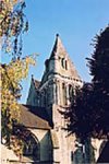
The Etouvy bridge was built in 1766, replacing an older one across the river Vire. Another stop was at Saint-Seve-Calvados, built around the Benedictine Abbey founded in the 11th century on the site of a hermit’s cell. St Sever was once bishop of Avranches. The route goes on through Villedieu-les-Poêles, a town that has thrived on the income from pilgrims on their way to, Mont-Saint-Michel. The production of metal objects, especially copper pans, has been goin on here since the 13th century, and its artits and craftsmen are justly renowned. The great bell foundry supplies church bells all over Europe. This path links numerous attractive small villages and often passes along the greenways, hollowed deeply over the centuries by the constant passage of travellers walking between the pastures and orchards that form the essential Norman landscape of the "Bocage".
STAGES
Total : 190 km – 9 stages
 TO GUIDE YOU
To order
Accomodations
PLACES AND LANDSCAPES
After Ouistreham and the Orne estuary the path arrives at Caen, the ancient Ducal city, before following the valley of the river Odon. It crosses from the great plain of Caen into the wooded valleys of the “Suisse Normande” via Evrecy, Hamars and St-Jean-le-Blanc before arriving in the heart of the bocage around Vire.
Passing close to Vire, it plunges through the forest of St Sever then the bocage of the southern Manche to arrive at Gênets, the last stage before crossing the sands to the Mount.
This route which starts on the coast is very green and picturesque, visting a number of little villages. It follows the valleys, with beautiful sections either on the heights or in deep hollows.
GPX files for GPS :
 - Ouistreham-Caen
- Caen - Evrecy
- Evrecy - Hamars
- Hamars - Danvou
- Danvou - Le Bény-Bocage
- Le Bény-Bocage - Saint-Sever
- St Sever - Villedieu
- Villedieu La Haye Pesnel
- La Haye-Pesnel Genêts
|