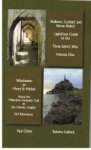
- Lightfoot Guide to the Three Saints Way - Winchester to Mont Saint Michel
- Paul Chinn - Babette Gallard
Guidebook From Winchester to Mont-Saint-Michel
LightFoot Guides are written for Walkers, Cyclists and Horse Riders, providing specofic information for each group and enabling everyone to meet their personal goals.
The name, Tree Saint’s Way, has been created by the authors of the LightFoot guide, but is based on the three saints associated with this pilgrimage : St Swithin, St Michael and St James. Far from being a single route, it is in fact a collection of intersecting routes, comprised of the Millenium Footpath Trail in England and the Chemin aux Anglais (from Barfleur) in France, which ultimately intersects with the St James Way in St Jean d’Angély. This book traces 243 kilometres from Winchester, England, to Mont-Saint-Michel in France.
The entire distance has been GPS traced and divided into manageable sections of approximately 15 kilometres, but accomodation (where it exists) is listed for the entire length of the section, meaning that it is up you and your body where you decide to stop.
Each section contains : a route summary; a cultural and historical overview of the region; detailed route instructions; the relevant map.
Each instruction sheet provides : detailed directions corresponding to GPS way points given on the map; verification points; compass direction for each way point; distance between each way point.
Each map provides : a north/south representation of the route with way point numbers; icons indicating places to stay, monuments etc.
To order
guidebook
(This guidebook is not available with the association "Les Chemins du Mont-Saint- Michel")
 From Winchester to Portsmouth
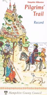
Pilgrim Trail
Informations : Email : info@hants.gov.uk
GPS
The way from Cherbourg on Google Map
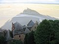
In the Middle Ages, the Mont Saint-Michel was one of the most important centres of pilgrimage in Christianity. Pilgrims came from England, Germany and Italy as well as France, and were known as the Miquelots, the follwers of St Michael. You can now explore the route used by pilgrims from England who crossed the Channel on their way to Mont Saint-Michel : the inland path, from Barfleur to the Mount, and the coastal path, starting from Cherbourg-Octeville. Altogether there are nearly 400 km of footpaths and small country lanes where you can explore the landscape and legends of the Manche, and enjoy the rich heritage of the Miquelots.
NORMAN HERITAGE ON THE WAY OF CHERBOURG
 Carteret On the cliffs of the Cape of Carteret, the ruins of the ancient church of St Germain stand on the wind swept moor. Bequeathed in 1225 to the monks of the Mont St Michel, ils recalls the legend of St Germain, who came from Scotland to evangelise the Cotentin peninsula and there fought a terrible dragon.
 Lessay. Founded in the 11th century in
the middle of a wild moorland, the Abbey of Lessay provided hospitality to travellers and pilgrims. Dedicated to the Holy Trinity, the Abbey church, one of the most famous in Norman Romanesque art, has been magnificently restored after its terrible destruction in 1944.
 Coutances. Visible across the countryside, the cathedral of Notre Dame rises high above the roofs of the little town of Coutances. This masterpiece of Norman gothic art was built around the remains of the earlier church erected in the eleventh century by the Bishop Geoffroy de Montbray. Several representations of the Archangel St Michael can be seen inside: a wall painting of the fourteenth century, a nineteenth century silver statue and in a stained glass window of the Last Judgement.
STAGES
 Cherbourg / Les Pieux (26 km)
Les Pieux / Barneville-Carteret (27 km)
Barneville-Carteret / Denneville (17 km)
Denneville / Lessay (22 km)
Lessay / Ancteville (29 km)
Ancteville / Hauteville-sur-Mer (27 km)
Hauteville-sur-Mer / Granville (23 km)
Granville / Saint-Jean-le-Thomas (23 km)
Saint-Jean-le-Thomas / Le Mont-Saint-Michel (14 km)
Total : 202 km – 9 stages
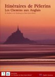
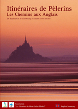
Our guidebook : « Itinéraires de Pèlerins – Les Chemins aux Anglais – De Barfleur et de Cherbourg au Mont-Saint-Michel »
It contains accounts by pilgrims of their journey and numerous illustrations showing the historic sites you will discover. Pratical index cards showing maps of 1 : 50000.
To order
Accomodations
<----
GPX files for GPS :

- Cherbourg - Les Pieux
- Les Pieux - Barneville-Carteret
- Barneville-Carteret - Denneville
- Denneville - Lessay
- Lessay - Ancteville
- Ancteville - Hauteville-sur-Mer
- Hauteville-sur-Mer - Granville
- Granville - St-Jean-le-Thomas
- St-Jean-le-Thomas - Le Mont
From Cherbourg to the way from Barfleur :
Cherbourg / Montebourg on Google Map
Fichier gpx :
- Cherbourg-Montebourg